Paul Fassam Geomatics Ltd
Multi-national Aerodrome Measured Height, Safeguarding and Wider Survey Services
Aerodrome Surveys to ICAO, CAA and Eurocontrol specification
Paul Fassam Geomatics are aerodrome survey specialists with services including:
- Measured height surveys
- Safeguarding and eTOD
- Aerodrome information plans (AIP)
- Comprehensive regulatory analysis
- Wider aerodrome and related infrastructure surveys
More detail about our business and services can be found at www.paulfassamgeomatics.co.uk.
Our Business
Paul Fassam Land Engineering and Building Surveys was established in 1988 by Paul D Fassam a Chartered Land Surveyor, Photogrammetrist and specialist aerodrome surveyor. This specialism was gained in work for the Royal Engineers and for the MOD over 16 years at more than 100 UK and overseas aerodromes.
Initially in 1988 the company provided precise engineering surveys, topographic surveys, building surveys and deformation monitoring. The company quickly established a large client base providing geodetic surveys worldwide using precise GPS and latterly GNSS technology. In 1996 an association with SERCO Aviation Services was established to provide worldwide aerodrome geodetic surveys for the implementation of WGS84. The company was incorporated in 2008 and continued trading as Paul Fassam Geomatics Ltd.
Working in 7 Continents Paul Fassam Geomatics has provided WGS84 geodetic aerodrome control based on UK, ETRF and ITRF networks. In Macedonia a full national geodetic network was established providing control for all airports. The derived national transformation parameters between WGS84 and UTM grid enabled the conversion of national data based on the UTM grid to WGS84.
Our Equipment
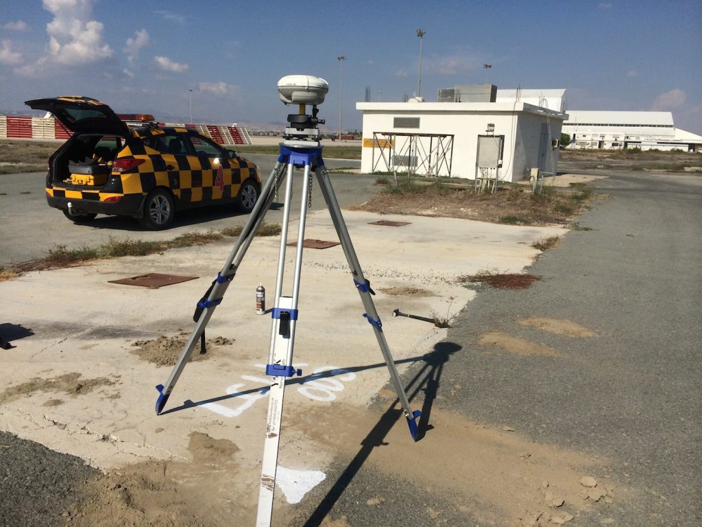
 Paul Fassam Geomatics Ltd provides concise accurate data by continually investing in and renewing its working practices and most importantly equipment.
Trimble GNSS receivers and radio base links are currently deployed worldwide. The geodetic GNSS control is also combined with the latest Trimble robotic total stations observations to provide a robust ADQ compliant survey methodology.
Laser scanners are deployed where high accuracy high precision point clouds are required. The latest additions include SUAs (Small Unmanned Aircraft) and third party piloted airplanes where wide area mapping is required.
As a leading service provider, we are always looking to develop new technologies. We see virtual reality and on screen pass-through as a promising development, especially for eTOD data and aerodrome safeguarding.
Company Profile
-
CAP232 Surveys
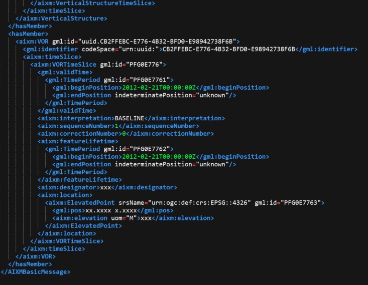
Obstacle measured height surveys are carried out covering the aerodrome OLS (Obstacle Limitation Surface) all data is captured using an ADQ compliant survey procedure. The captured data is controlled using an in house database program, this not only enables reporting of obstacles in an automated ADQ compliant procedure but is future proofed and will enable the direct export of AIXM 5.1 obstacle and runway data.
Reporting conforms to all current CAA, EASA and ICAO specifications.
Image: AIXM 5.1 compliant reporting
-
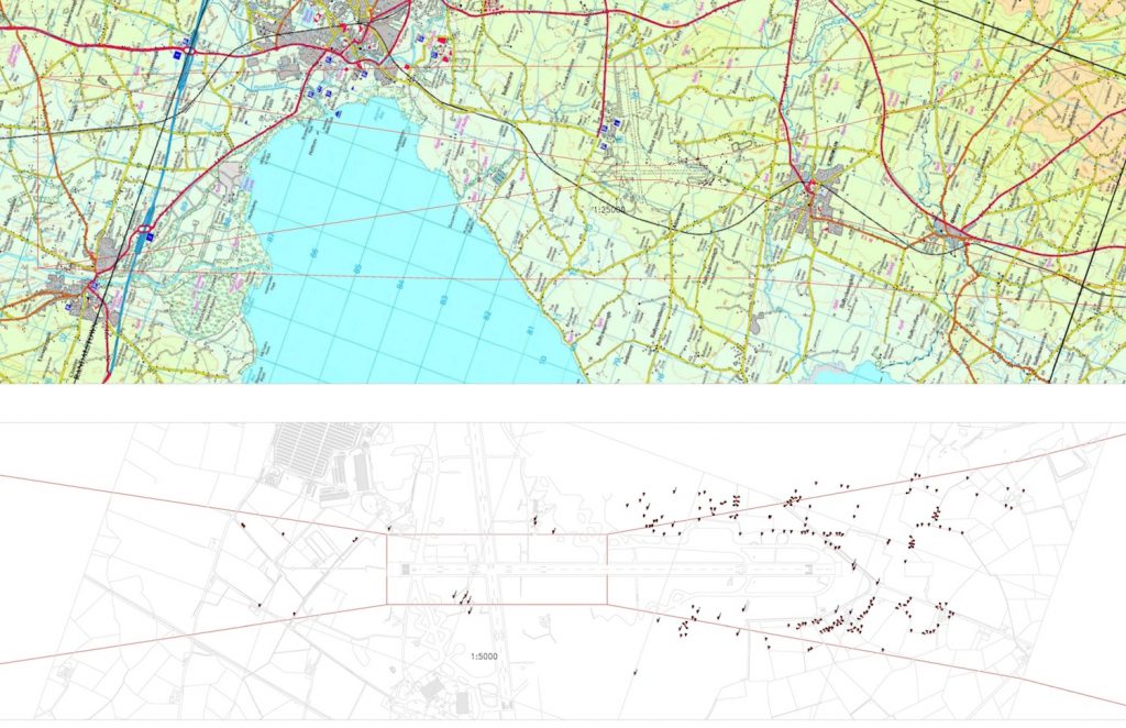
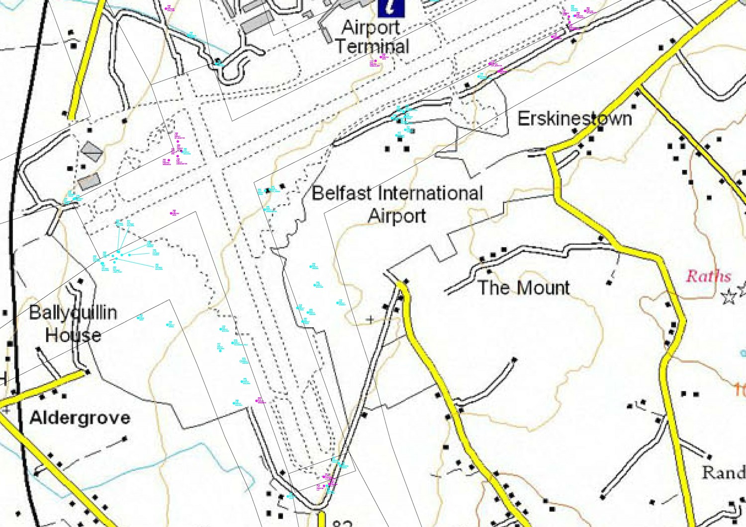
Safeguarding and eTOD
We provide a personal care package for each airport. This service enables airports to concentrate on their core business and leave the safeguarding, protection and maintenance of the OLS (Obstacle Limitation Surface) to Paul Fassam Geomatics. An aerodrome database program developed in house provides an automated response to planning applications and other planning matters, this method is fully ADQ compliant. This interface is accessible online with a mobile phone or laptop using a simple password. No staff training expensive software or expertise on site is required.
Image: Safeguarding Plans

-
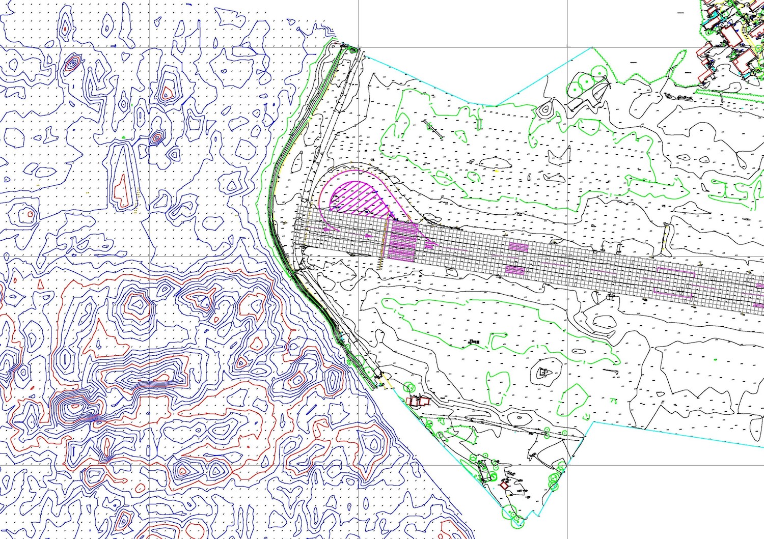
Aerodrome Information Plans
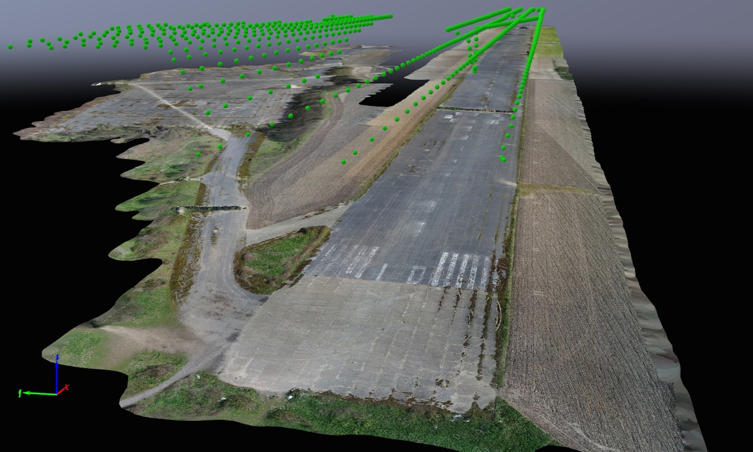
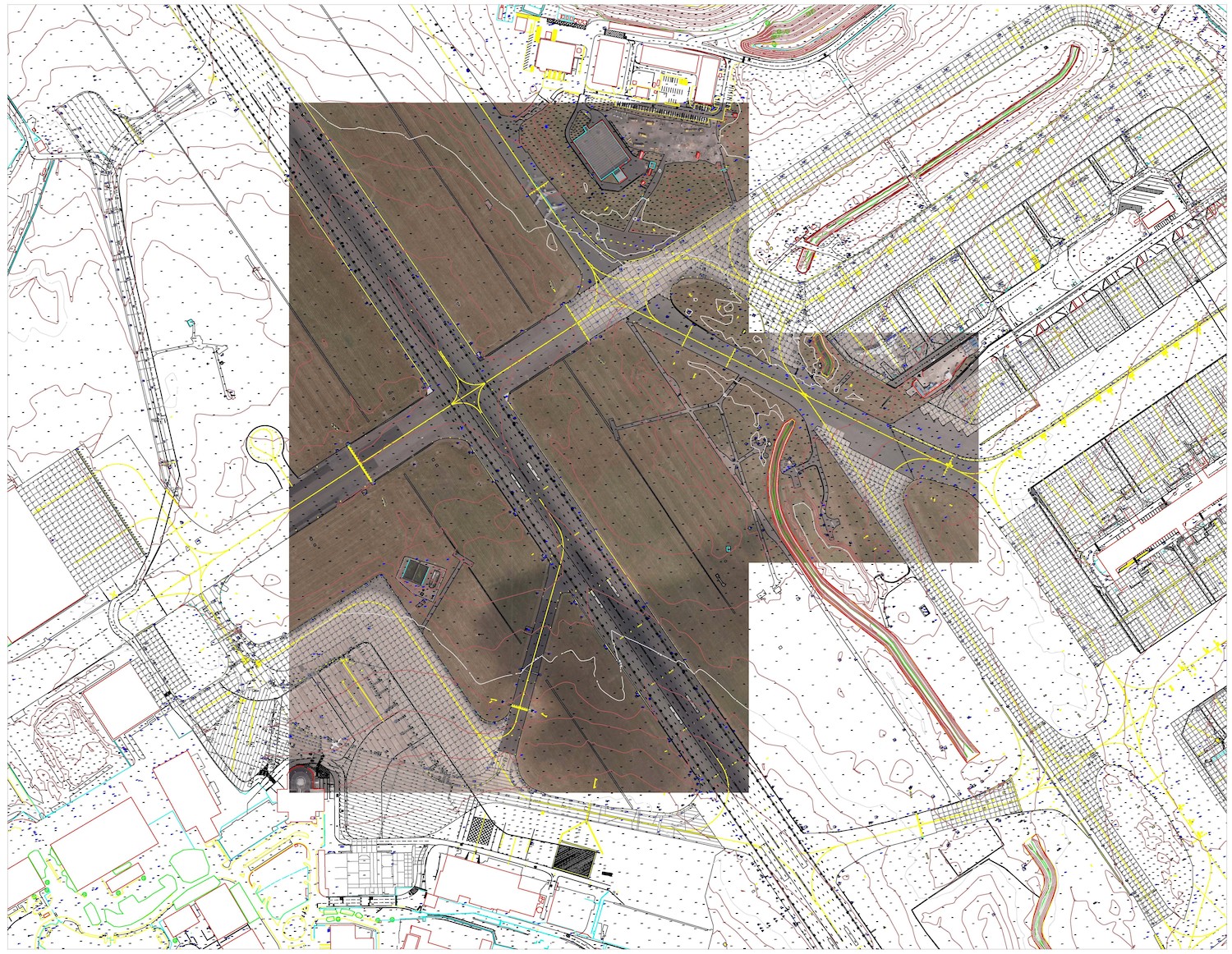
Aerodrome plans have always been produced using traditional ground survey techniques, SUA technology has advanced to the point where large amounts of data can be captured to ICAO, EASA and CAA required precision. Access to airside is reduced and occupation times are kept to a minimum. Paul Fassam Geomatics have proved that a hybrid system of ground survey alongside SUA data capture will provide accurate data at a reduced cost to the aerodrome operator.
All OLS areas are mapped and a full analysis of the aerodrome data carried out. The resultant plans comply fully with current legislation and are future proofed in order to encompass the proposed change to AIXM 5.1 format.
Image: Precision Approach Chart
-
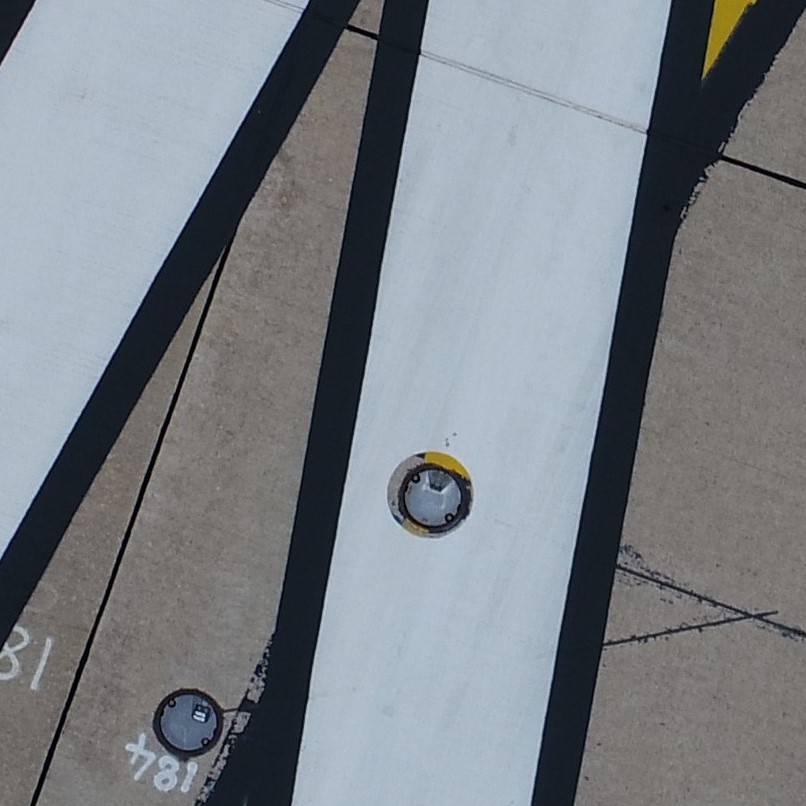
SUA Pavement Inspection
Paul Fassam Geomatics Ltd has been pioneering drone technology around airfields for some time now. Drone pavement inspections are our latest offering which promise to revolutionize this historically slow practice.
Using either a multi-rotor or fixed wing aircraft, a low-level grid is flown over the hardened areas. High-resolution photography captures the surface to a resolution in excess of 3mm. These photos are then rectified to produce a flat 1:1 image of the entire survey area. The image allows pavement inspectors to safely measure and mark features in the safety of their office.
Overall this method greatly improves the deliverable whilst also saving time on site. The UAV can operate safely between flights under the control of ATC.
Image: Pavement Inspection
-
EASA Compliance Analysis
Paul Fassam Geomatics Ltd works with airfields to create detailed physical assessments of compliance with major regulations. We completed a major British Military contract relating to the physical condition of 14 of its aerodromes. From a short survey our software reports on the slopes, dimensions, paint markings, distances and heights etc. across the entire airfield. This allows for comprehensive analysis to the relevant regulatory standard.
Image: Aerodrome Gradient Reporting
-
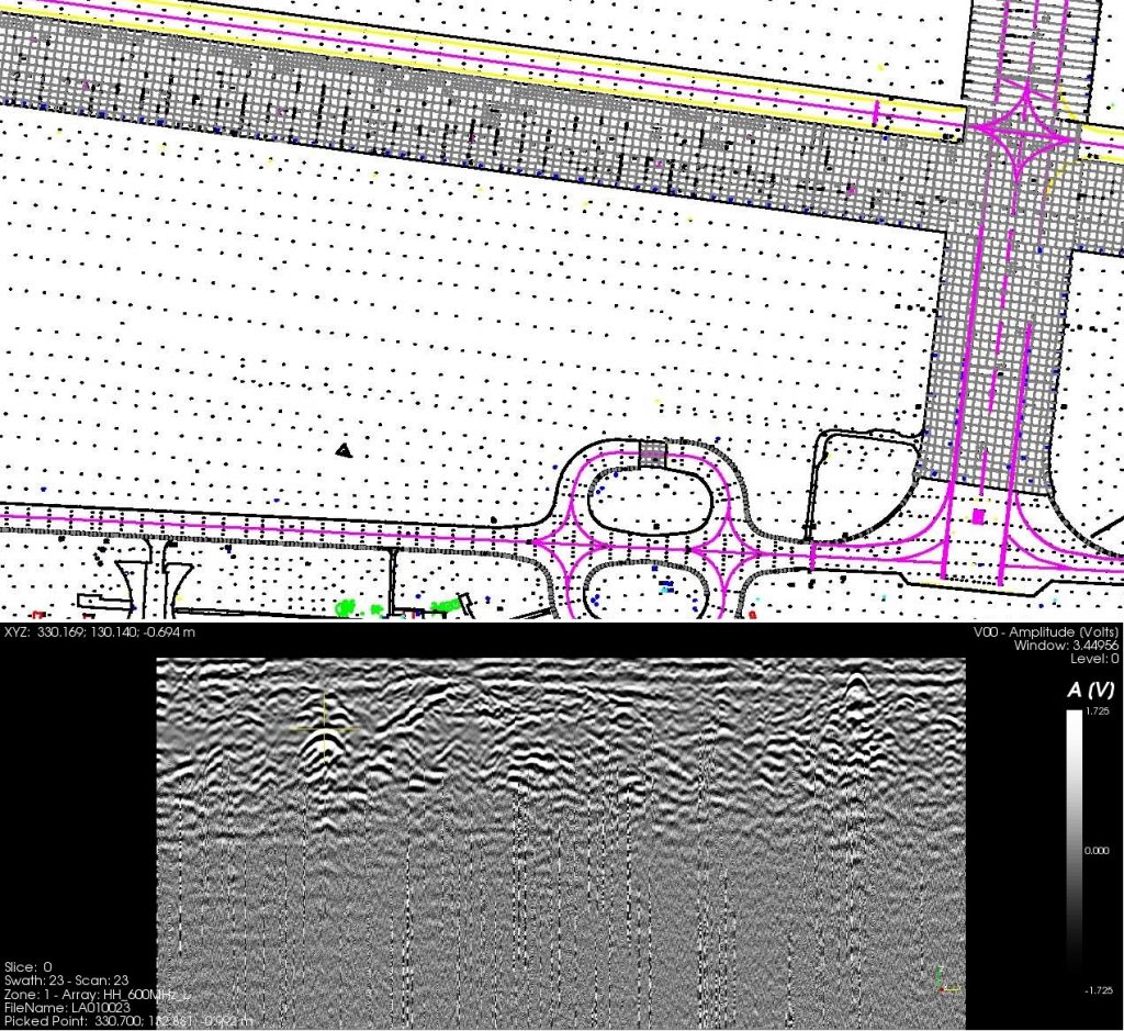
PAS128 Underground Surveys
We provide a full suite of services to provide greater confidence to clients in underground utility detection, maintenance, and replacement of underground services.
- Electronic detection of buried services
- Ground penetrating radar (GPR)
- UXB surveys
- Remote visual surveys
- Inspection chamber records
- Interpretation of historical data
PAS 128 provides a robust methodology for delivering utility surveys in the UK. It focuses on levels of accuracy – referred to as Survey Category Types – that you can specify when requiring a PAS 128 compliant underground utility survey.
Image: GRP Survey
-
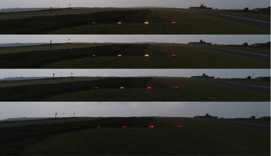
PAPI Siting and Calibration
Paul Fassam Geomatics Ltd offers PAPI siting using a drone to capture high resolution images at high precision locations. This method offers a cost-effective solution when compared to commercial aircraft data capture.
We also offer ground based PAPI calibration using topographic information and inclinometer readings.
Image: Drone PAPI Siting
-
Wider Services
Topographic, hydrographic, photogrammetric, ground penetrating radar, radio detection and laser scanning surveys are used to produce aerodrome infrastructure surveys for rehabilitation, redevelopment and feasibility planning.
Project examples include:
Gan Aerodrome Addu Atoll Maldives
Hydrographic and Topographic Survey
Birmingham International Airport
Photogrammetric Survey Includingo Ortho Mosaic Tiles
Aerodrome Management Charts
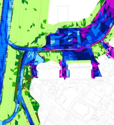
Management charts are produced which identify obstacles identified within the OLS penetrations that can be managed. Colour codes are used to differentiate between manageable and non manageable obstacles.
Aerodrome Management Chart
Images
Contact
Plymouth Science Park
Davy Road
Derriford
Plymouth
United Kingdom
PL6 8BX
- +44 (0) 1752 907355